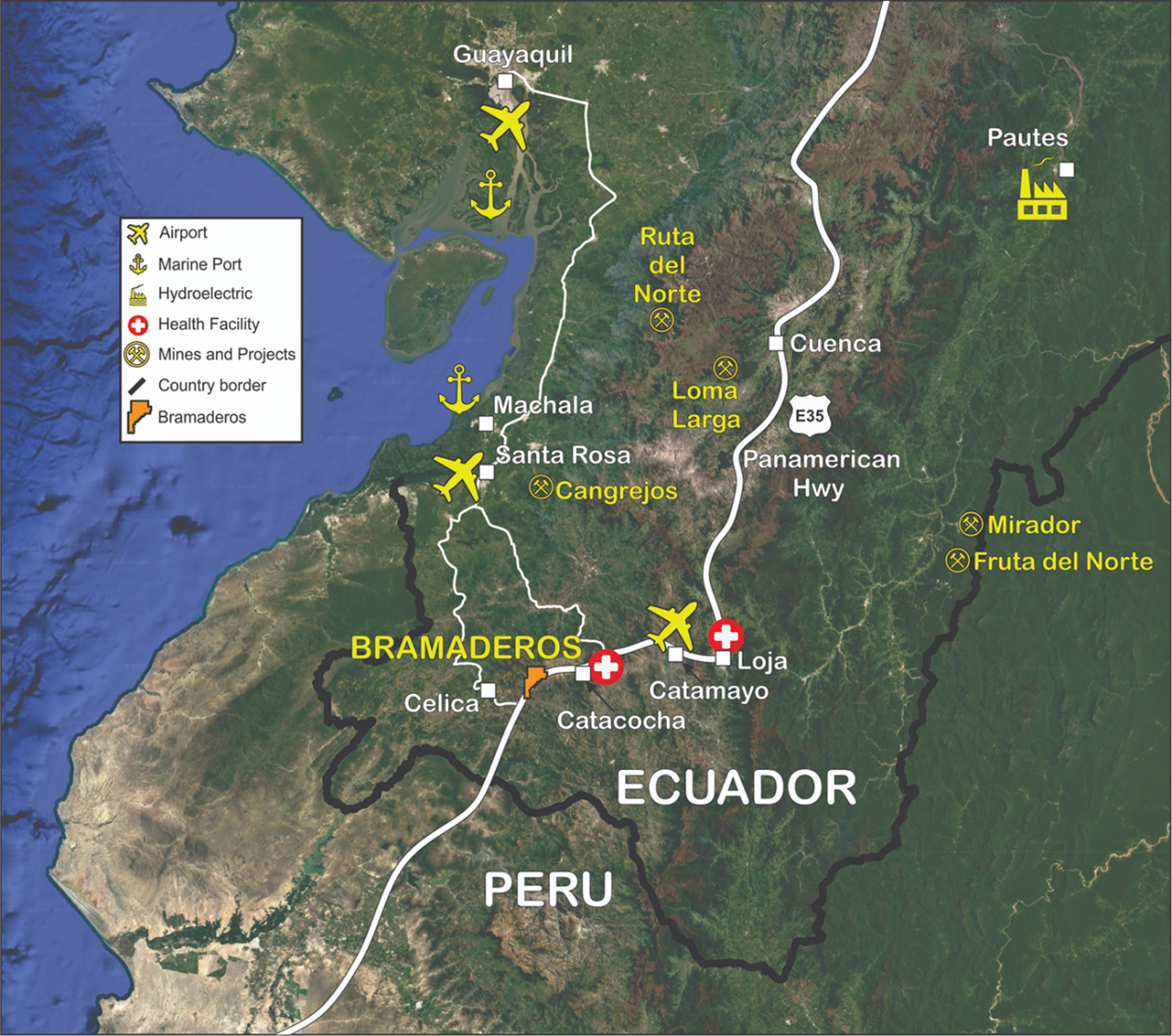
Project Setting

The Bramaderos property is centred approximately 69km west-southwest of the provincial capital city of Loja, 213km south-southeast of the coastal city of Guayaquil and 460km south-southwest of Quito. Geographic coordinates at the centre of the property are approximately 79°48'20'' west longitude and 4°04'25'' south latitude. Elevations on the property range from 697m above sea level (MASL) in the south to 1804 MASL in the northwest along the Cordillera Celica. Local relief is generally moderate, although the terrain steepens as elevations rise toward the northwest side of the property.

The Bramaderos property is accessible from the west coast by bitumen road from Ecuador’s largest city Guayaquil to the port city of Machala for approximately 187km, then approximately 195km from Machala to the village of Bramaderos via Alamor and Celica. The journey by road from Guayaquil to Baramaderos takes approximately 6 hours, while from Machala is approximately 2.5 hours.

Guayaquil is serviced by both international flights from Santiago (Chile) and Lima (Peru) and by multiple domestic flights from Quito. The provincial capital Loja is also serviced by multiple daily flights from the capital city of Quito to Catamayo, located 94km east of the Bramaderos property.

The Ecuadorian segment of the Pan American Highway (known as Highway 35) extends from Tulcan on the Colombian border south to the capital Quito, then south to Loja and extending through the Bramaderos Property on its way to the southern border with Peru.  

The nearest village (pueblo) is Bramaderos which lies around 400m west of the Pan American Highway within the property, and comprises a small cluster of approximately 50 houses. The various mineral prospects on the Bramaderos property are accessed by either well-maintained dirt roads and/or by paths from off the Pan American highway.   

The climate is dry equatorial, hot and semi-arid with a moderate wet season that extends from December to May and a pronounced dry season from June to November. The range of average monthly minimum and maximum temperatures for Casanga (located just 9km northeast of the project at similar elevations) are 13-18.0C and 27-32C respectively. The average annual rainfall at Casanga is 1127mm. The climate is amenable to year-round exploration and mining activity.

The land use is dominantly pastoral, with local areas of agriculture on the property involving maize and peanut crops, however this is relatively minimal due to the arid climate of the region. Parts of the property are sparsely stocked with cattle and locally over-grazed. Vegetation is stunted and open in most areas, being generally sparsely wooded with an understory of shrubby vegetation and only local areas of dense undergrowth.

Local resources and infrastructure are minimal in the immediate Bramaderos area, although substantial resources and infrastructure exist in nearby centres.

The nearest domestic airport is at Catamayo, with additional airports at Santa Rosa and Cuenca. The nearest international airport is at Guayaquil. Both Machala and Guayaquil have major port facilities. A small regional health centre lies near the northeast margin of the Bramaderos property whilst a major hospital with substantial facilities exists in Catacocha 35km east of Bramaderos.

A hydro-power line passes through the Bramaderos property area in the vicinity of the Brama prospect and could potentially be tapped to provide electrical power.

The Bramaderos property lies entirely on the western side of the Playas river (“Rio”) valley, with the main Rio Playas drainage running just outside of the eastern margin of the property. The Rio Playas drains into the Rio Catamayo which drains southwest-ward into northern Peru where it becomes the Rio Chira which flows westward to the Pacific. The Bramaderos Property area is characterized by gentle to moderately steep topography and typically comprises small conical hills and ridges separated by wide flat-bottomed valleys.

Several regularly-spaced and southeast-draining tributaries to the Rio Playas transect the property. These tributaries dissect the landscape into a series of northwest-southeast aligned ridges with vertical reliefs of 50 to 250m. Water supply is good in the wet season in the vicinity of the major rivers such as the Rio Playas and Rio Catamayo, but is variable to poor elsewhere. During the dry season the most reliable water supply can be obtained from the Rio Catamayo.